
Desert Hiking Among Joshua Trees and Giant Boulders
Twisty, spiky, weird looking Joshua Trees. Giant boulders. Inhospitable desert.
A beautiful day in December is a great time to visit and see the fascinating and strange landscape in the Joshua Tree National Park.
Just what is a Joshua Tree?
A.) The name of an awesome album by rock band U2
B.) A Yucca plant in the Agave family
Forests of this odd looking Yucca Brevifolia plant stretch as far as the eye can see in the park. Legend has it that Mormon settlers named the tree after the biblical figure Joshua, limbs outstretched in supplication guiding the travelers westward. The name stuck and forevermore the Yucca Brevifolia is The Joshua Tree, the national park’s namesake.
On the way to the National Park you see some Joshua Trees, but when you drive in from the west entrance and drop down into the Lost Horse Valley to see mile after mile of Joshua Trees stretching their limbs to the sky it’s a big WOW moment.
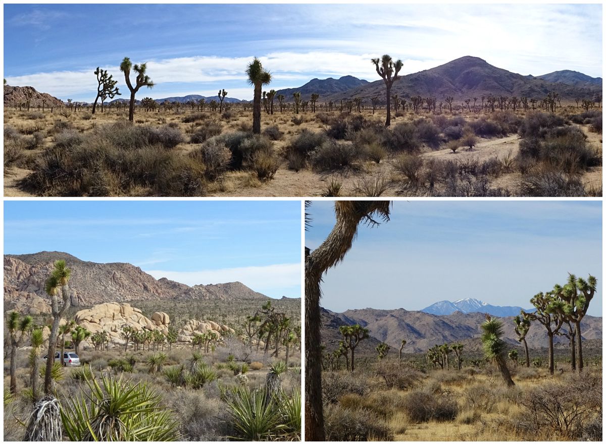
Forests of Joshua Trees in the Lost Horse Valley; The snow capped San Gorgonio Mountain seen from the Lost Horse Valley
In the 1800’s this huge area was home to ranchers who grazed their cows here. When you look around at all that desert it seems impossible that there once was enough grass for one cow let alone herds. Gold miners were here too and left their mark on the landscape with abandoned mines and cars. In the 1900’s homesteaders filed claims and eked out a living. Some of the most interesting walks and hikes center around the sites and structures from these past times.
We’ve hiked a few different trails in the park before, but on this cool day with a late start all we were up for was a nature walk in Hidden Valley, a desert hike to the Wall Street Mill, and a stop at the Keys Viewpoint.
Hidden Valley Nature Trail
This nature trail is a short and sweet loop in a little valley accessed through a pass blasted through the massive boulders by a cattleman who wanted to graze his cows in the hidden valley. Other legends tell the tale that the valley was once a hiding place for cattle rustlers. The signs along the trail make it an interesting and educational one mile walk among the giant boulders.
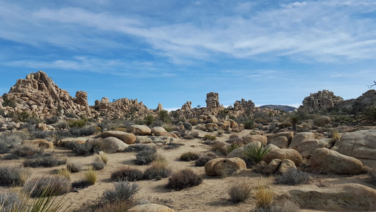
Giant Boulders in the Hidden Valley
Wall Street Mill Trail
In 1928 two miners in search of gold filed a claim at the site of a well, built a cabin, and named the site “Wall Street.” After a couple of years they left and William Keys (you’ll see THAT name throughout the park!) bought the Wall Street Mill site, filed a mining claim, and moved a two-stamp ore crusher mill to the site. The Wall Street Stamp Mill is in the National Register of Historic Sites. It was a complete gold ore crushing mill featuring late 19th century two-stamp mill machinery.
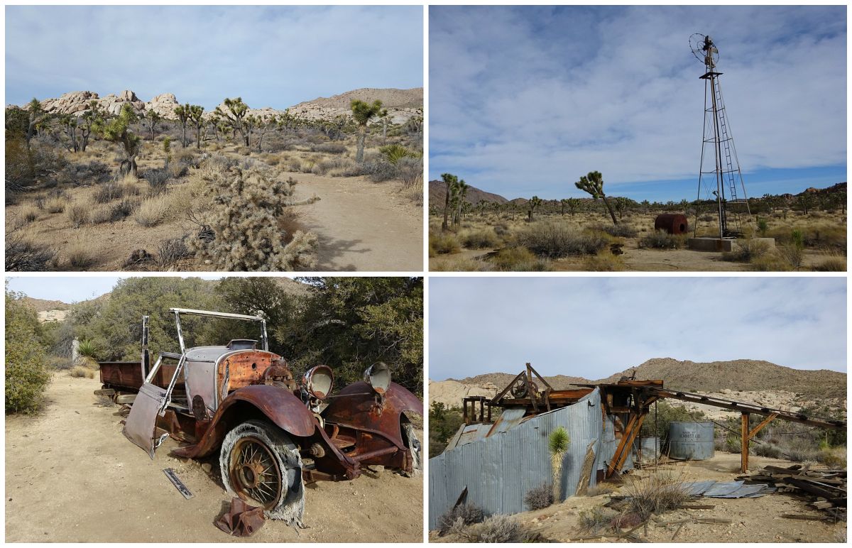
Wonderland of Rocks at the Wall Street Mill; Old Windmill at the side of the trail; End of the line for this car; Wall Street two-stamp mill
The Wall Street Mill trail is an easy 2.2 miles round trip, with much of the trail in a sandy desert wash below the level of the surrounding terrain. Be forewarned – if you wander off the trail you may not find it again. A few years ago we headed off to see the mill and made a detour over to the base of some huge rocks for a look at the ruined foundations of a cabin and rusting wreck of a car. Then we headed in the direction we knew the mill had to be, but in the sandy desert with footprints going in all directions it all looked the same. Too late in the day to be wandering around the desert looking for the Mill, we only picked up the real trail again on our way back to the parking lot.
This time we headed up the wash that was the trail, checked out the interesting Mill and headed back out…wait a sec…we were not on the trail once again. We’d headed out a wash that looked like the trail but got narrower and narrower with the cholla cactus and other spiny desert plants closing in. What did I tell you? It can all look the same.
Tip: The Barker Dam Nature Trail is another fun 1.3 mile interpretive loop trail that shares the same parking lot as the Wall Street Mill Trail.
Keys View
A trip to Joshua Tree National Park isn’t complete without a stop at the mile high Keys View. This viewpoint overlooks the broad expanse of the Coachella Valley with Palm Springs below. Far to the left you may be able to see the Salton Sea. Why all this haze? Clear days are infrequent, there’s even a sign at the viewpoint describing the ever present haze of smog that has blown in from nearby urban areas.
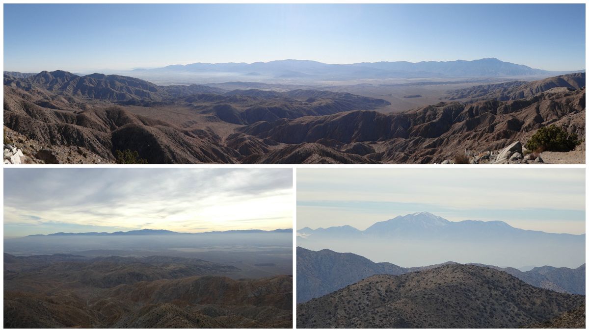
A clearer day in December 2011; Hazy day in December 2015; View of the snow covered San Gorgonio Mountain from Keys View
If you don’t have time for a hike or a nature walk you can do a drive through the park, pulling off the road at the many information turnouts where you can conveniently read all about it from your car. Another fun drive is the Geology Motor Tour, a dirt road with 16 stops pointed out on a PDF map you can print out from the National Park website.
U2’s The Joshua Tree (1987)
So what about that great U2 album “The Joshua Tree”? One of my favorites, it’s #27 in the Rolling Stone 500 Greatest Albums of All time. American desert imagery was inspirational in the album’s conception and the religious significance of the name of the Joshua Tree fit with the spiritual theme of many of the songs.
Practicalities
Pack a picnic lunch, snacks and plenty of water.
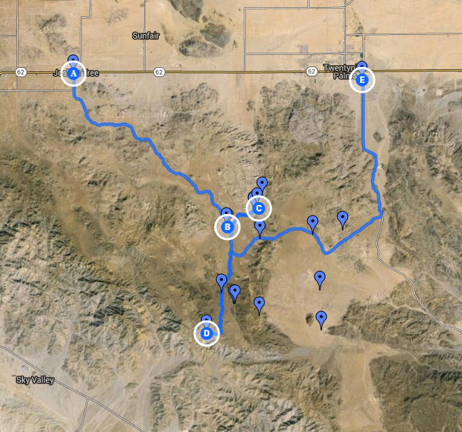
My Joshua Tree National Park Route Map
Have you been to the Joshua Tree National Park? What did you think about this landscape?


Didn’t realize that you were such a hiker Rebecca! Just beautiful landscapes, I would love to do that.California seems to have so many beautiful hikes…
Frank (bbqboy)
Frank recently posted…Photo Essay: the Atlantic Coastline of Cape Town
Hiking, biking… oh yes! 2 feet or 2 wheels is a great way to really see and appreciate where you are, and winter is a perfect time to go to the desert. You just have to be aware of how short the days are and not wander off into that vast, you know…desert.
After our first time to Joshua Tree, I’d have to agree that it’s worth multiple visits. We’ll be back.
Tom Bartel recently posted…St. Paul’s Shipwreck Church, Valletta, Malta
Joshua Tree NP is a terrific excursion, especially if you’re staying in Palm Springs. Hiking in the daytime and a great place to spend the evenings – my kind of vacation!
Rebecca recently posted…Christmas Eve in Robolights Land
Wow, it looks amazing, I think we might need to visit next February for Christina’s birthday!
Justin recently posted…Sarah goes to Thailand (part 1)
Those forests of Joshua Trees are really something to see, and February usually has great weather in Palm Springs. Modernism Week is in February too so the town is hopping with all the mid-century modern fans. Fun time to visit!
Rebecca recently posted…Biking a Mid-Century Modern Tour in Palm Springs